Drainage Design
Drainage Planning & Design
Drainage for Transportation
• Stormwater management system design for FDOT, County and municipal transportation facilities including airports, interstate, turnpike, urban, and rural roadways
• Drainage retrofit of stormwater management systems for transportation facilities
• Drainage for Resurfacing, Restoration and Rehabilitation (3R) projects
• Storm sewer network analysis using ASAD and Geopak Drainage
• Pond siting analysis for PDE studies
• Hydraulic analysis of existing roadway culverts and floodplain statements
• Bridge Hydraulic Report (BHR) analysis preparation, including scour analysis.
• Sea Level Rise studies and implementation of resilience improvements, including backflow prevention and pump station design.
Storm Water Management
• Design and specifications of channels, storm sewers, and retention/detention
• Environmental Resource Permitting (ERP)
• Hydrologic and hydraulic modeling with HEC-HMS, HEC-RAS, WSPRO, HY-8, ASAD, Geopak Drainage, FlowMaster, StormCAD, SewerCAD, WaterCAD, AdICPR versions 3 and 4, and XPSWMM.
• Level of service (LOS) analysis of existing drainage systems for retrofit engineering design, permitting, and implementation.
• Hydraulics & Hydrology (H&H)/water quality modeling for regulatory compliance (NPDES/TMDL’s) studies.
• Benefit/Cost analysis of alternative water management plans.
Watershed Master Planning
• Hydrologic and hydraulic (H&H) modeling of local and regional watersheds using one, two-dimensional and hydrodynamic surface water models, point and non-point source water quality models.
• Regional watershed water supply optimization analysis, wetland watershed ecosystem hydroperiod analysis, and watershed environmental restoration.
• Typical computer models applied include: SWMM, XPSWMM, ICPR (versions 3 and 4).
• Arc Hydro database development and interface for H&H modeling.
• ArcGIS for GIS for H&H modeling database development, environmental assessment and mapping.
• ARC GIS tools for H&H data creation
• Master planning for Capital Improvement Plan Implementation (CIP)
FEMA Pre-Flood Planning Mapping and Post-Flood Damage Assessment
• Preparation of FISs, PMRs, CLOMRs and LOMRs with acceptance by FEMA
• Preparation of countywide DFIRM Maps, DFIRM databases and FISs, with MIP data management
• Use of geospatial data with GIS and AutoCAD in hydrologic and hydraulic modeling, floodplain map preparation and database creation
• Hydraulic modeling of river systems, in both 1-D and 2-D, using steady-state and unsteady modeling techniques
• Evaluation and delineation of floodplains and floodways in normal, split flow and looped flow situations
• Use of industry standard automated tools, as well as the development and use of in-house automated tools, for hydrologic and hydraulic modeling applications, floodplain and floodway delineation, and DFIRM/FIS production
Flood Control Engineering
• Floodway encroachment analysis using HEC-RAS, WSPRO, XPSWMM, ICPR versions 4
• Utilizing LiDAR data to produce Digital Elevation Model (DEM) for terrain modeling.
• Flood relief operational plan development and computer simulation

Lejeune Road Ponds
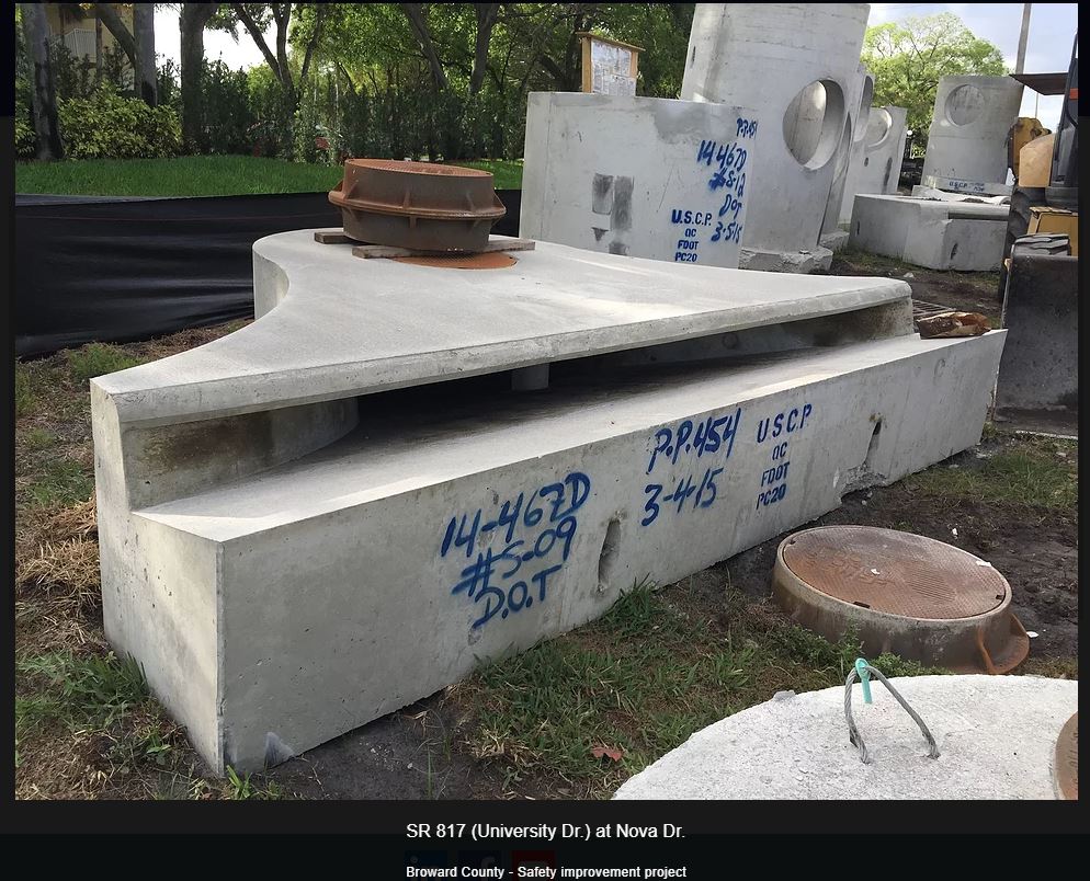
SR 817 (Broward County)